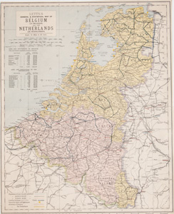
BELGIUM AND THE NETHERLANDS (HOLLAND) |
Thumbnail
(Click to enlarge) |
Title / Publisher
Date
Size
in inches |
| 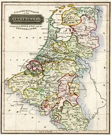
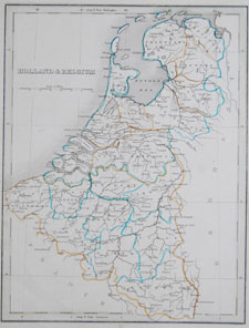
click thumbnail for more info
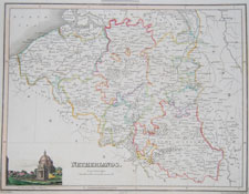
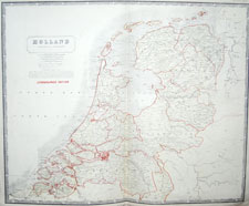
Belg/NL-15 |
1817
approx. 9 x 11 inches
|
| 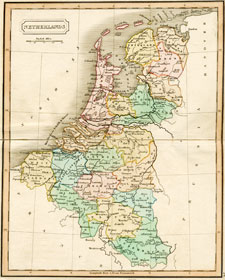
click thumbnail for more info
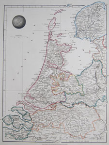
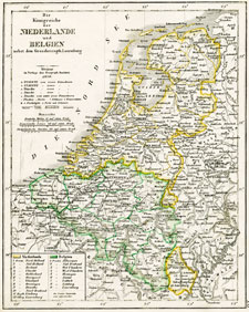
Belg/NL-16 |
Netherlands
Dr. Brookes's General Atlas of Modern Geography
William Darton, London
1817
approx. 8 1/4 x 10 inches
|
| 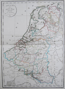
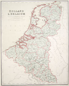
click thumbnail for more info
Belg/NL-17 |
1819
approx. 13 x 19 1/4 inches
|
| 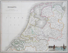
click thumbnail for more info
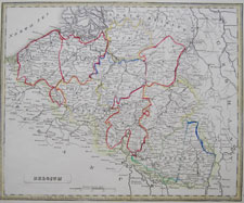
Belg/NL-18 |
Holland
A General Atlas, containing Maps illustrating some important periods in Ancient History and distinct Maps of the several Empires, Kingdoms and States of the World, From Original Drawings according to the latest Treaties, by J. Wyld and Engraved by N.R. Hewitt
Edinburgh, John Thomson & Co.
1819
approx. 13.25 x 10 inches
|
| 
click thumbnail for more info
Belg/NL-19 |
Netherlands A General Atlas, containing Maps illustrating some important periods in Ancient History and distinct Maps of the several Empires, Kingdoms and States of the World, From Original Drawings according to the latest Treaties, by J. Wyld and Engraved by N.R. Hewitt
Edinburgh, John Thomson & Co.
1819
approx. 13.25 x 10 inches
|
| 
click thumbnail for more info
Belg/NL-20 |
Holland
Outlines of the World
London, Aaron and Samuel Arrowsmith
1825
approx. 11 x 14.75 inches
|
| 
click thumbnail for more info
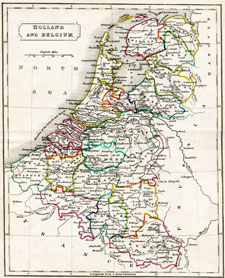
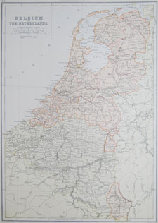
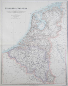
Belg/NL-21 |
Holland and Belgium
An Atlas of Modern Geography by Samuel Butler, D.D.
London, Longman, Rees, Orme, Browne & Green
1831
approx. 8.5 x 11 inches
|
| 
click thumbnail for more info
Belg/NL-22 |
1844
approx. 8.5 x 10.75 inches
|
| 
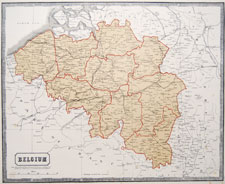
click thumbnail for more info
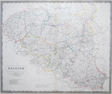
Belg/NL-33 |
Belgium
The National Atlas of Historical, Commercial, and Political Geography...
Alexander Keith Johnston, 1850
approx. 21 x 25 1/2 inches
|
| 
click thumbnail for more info
Belg/NL-23 |
1850
approx. 9 x 10.5 inches
|
| 
click thumbnail for more info
Belg/NL-24 |
Belgium
A New General Atlas, being a collection of maps of the World & Quarters; the various Empires, Kingdoms & States, In the Known World; agreeably to the best Authorities, & in Accordance with Modern Discovery. With all the Improvements, Railroads &c. &c. &c.
London, Thomas Johnson
1848
approx. 15 x 13 inches
|
| 
click thumbnail for more info
Belg/NL-25 |
1882
approx. 11 x 15 inches
|
| 
click thumbnail for more info
Belg/NL-26 |
circa 1850
approx. 10.25 x 13.25 inches
|
| 
click thumbnail for more info
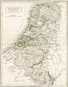
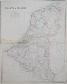
Belg/NL-27 |
Holland and Belgium
Chambers's Atlas for the People
William and Robert Chambers, London and Edinburgh
circa 1855
approx. 10 x 12 inches
|
| 
click thumbnail for more info
Belg/NL-28 |
1863
approx. 16.5 x 14 inches
|
| 
click thumbnail for more info
Belg/NL-29 |
Belgium
The National Atlas of Historical, Commercial, and Political Geography, constructed from the most recent and authentic sources
by Alexander Keith Johnston, F.R.G.S.
Edinburgh: John Johnstone and W. & A.K. Johnston
Glasgow: James Lumsden & Son
1849
approx. 25 x 20.5 inches
|
| 
click thumbnail for more info
Belg/NL-30 |
Holland
The National Atlas of Historical, Commercial, and Political Geography, constructed from the most recent and authentic sources
by Alexander Keith Johnston, F.R.G.S.
Edinburgh: John Johnstone and W. & A.K. Johnston
Glasgow: James Lumsden & Son
1849
approx. 25 x 20.5 inches
|
| 
click thumbnail for more info
Belg/NL-31 |
1854-1862
approx. 19 x 23.5 inches
|
| 
click thumbnail for more info
Belg/NL-32 |
1854-1862
approx. 19 x 23.5 inches
|
| 
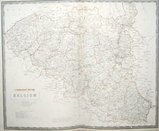
click thumbnail for more info
Belg/NL-33 |
1854-1862
approx. 12 5/8 x 18 3/4 inches (32 x 47.6 cm)
|
| 
click thumbnail for more info
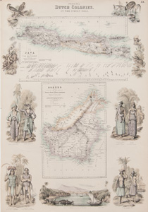
Belg/NL-34 |
1854-1862
approx. 12 5/8 x 18 3/4 inches (32 x 47.6 cm)
|
| 
click thumbnail for more info
Belg/NL-35 |
1884-87, London
approx. 12 7/8 x 16 1/8 inches (32.7 x 41 cm)
|
| 
click thumbnail for more info
Belg/NL-36 |
1884-87, London
approx. 15 3/4 x 13 3/4 inches (40 x 35 cm)
|
| 
click thumbnail for more info
SANSON-10 |
circa 1707
Overall FRAMED size = approx. 31 1/4 x 27 3/4 inches (79.3 x 70.5 cm) please excuse glare/reflection from glass
Image size (to double mat opening) = approx. 23 1/2 x 20 inches (59.7 x 50.8 cm)
|

PREVIOUS PAGE OF BELGIUM/NETHERLANDS MAPS |